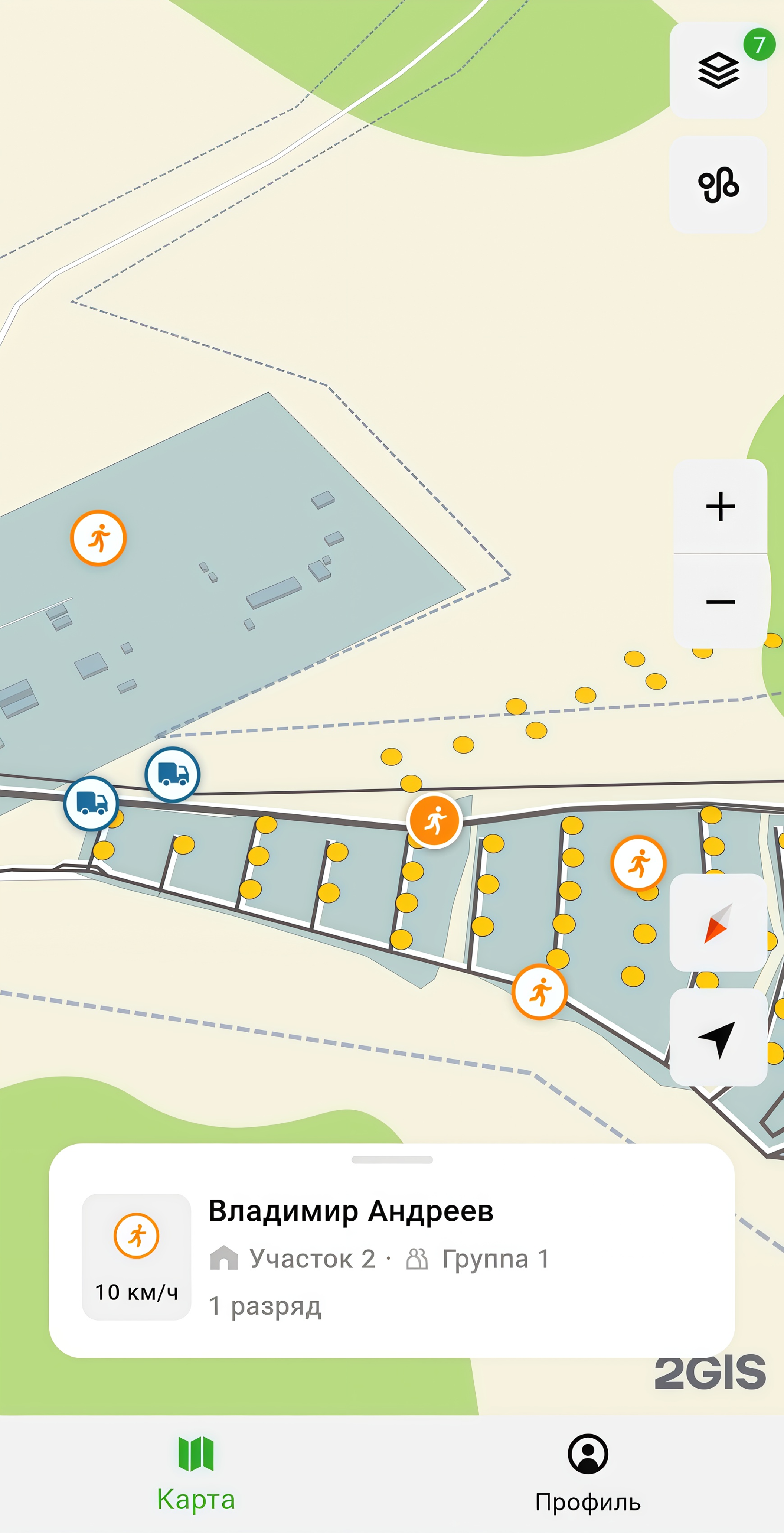
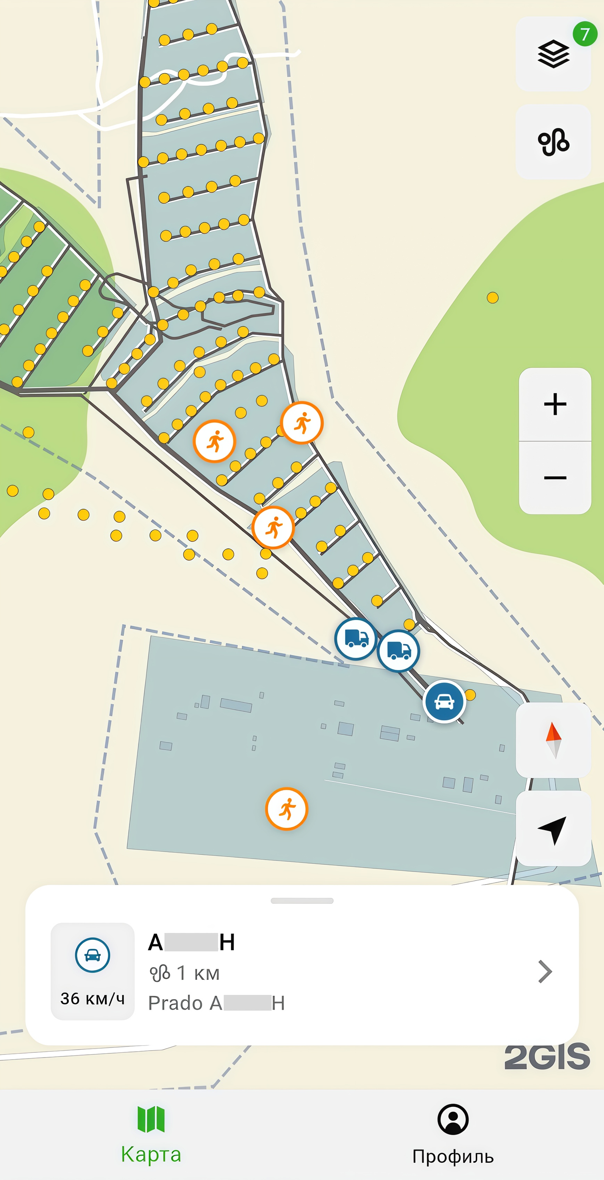
Working with the map
The Map tab displays the area map with additional objects:
- Map areas with organization infrastructure: auxiliary geozones (with residential, administrative, utility, and other facilities) and production geozones (areas for performing work).
- Monitoring objects: mobile employees from the group, transport, etc.
Important
This section provides screenshots with examples of the interface in Russian.
Click the object you are interested in to view its information:
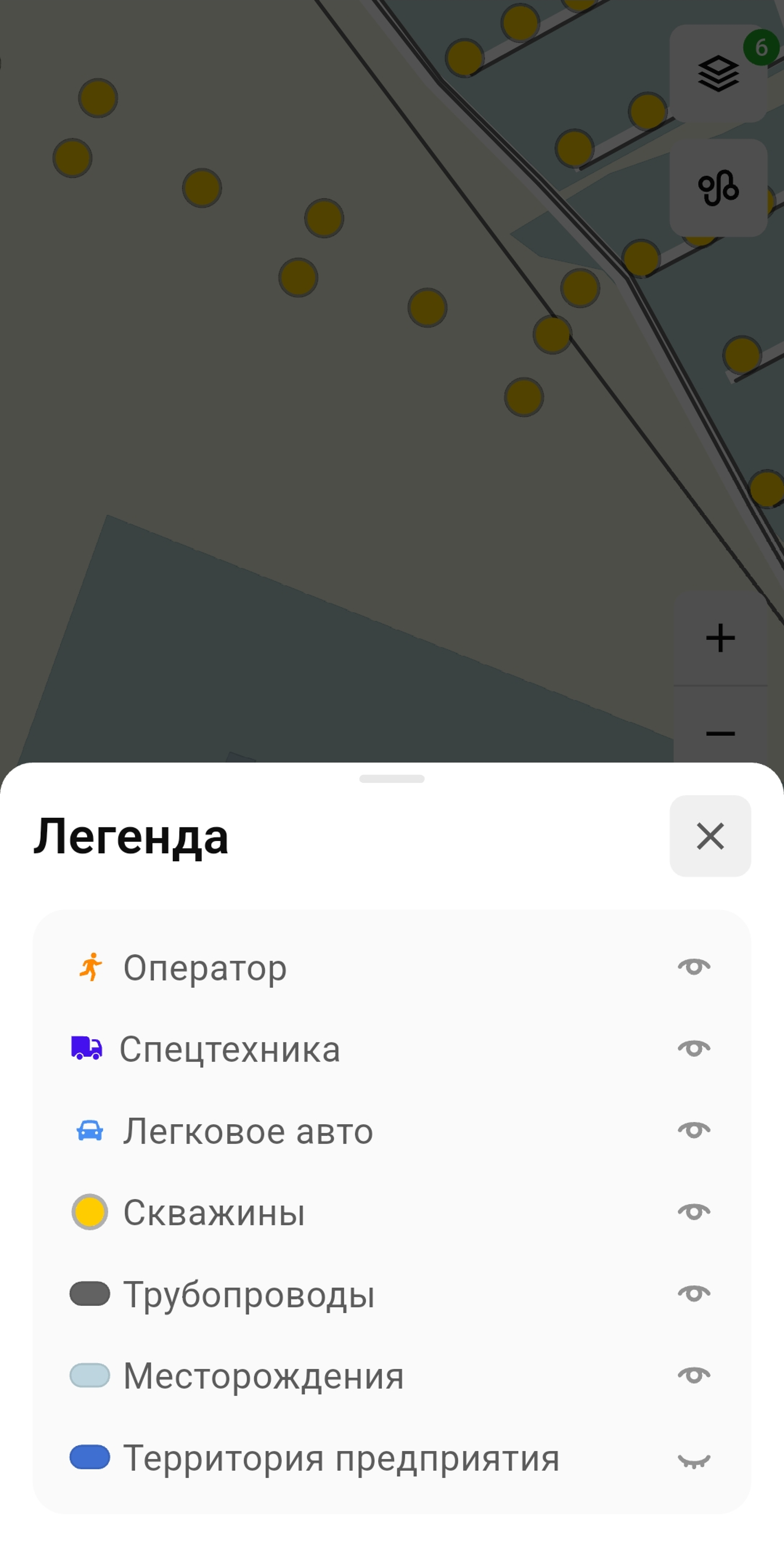
Object visibility on the map
To manage the visibility of objects on the map, click ![]() icon. In the opened Legend window, click
icon. In the opened Legend window, click ![]() icon next to the required type of objects to hide or show them on the map.
icon next to the required type of objects to hide or show them on the map.
An example of a legend:
Tracked route
During work, your movements are recorded and saved as a GPS track. To display the track on the map, click ![]() icon:
icon:
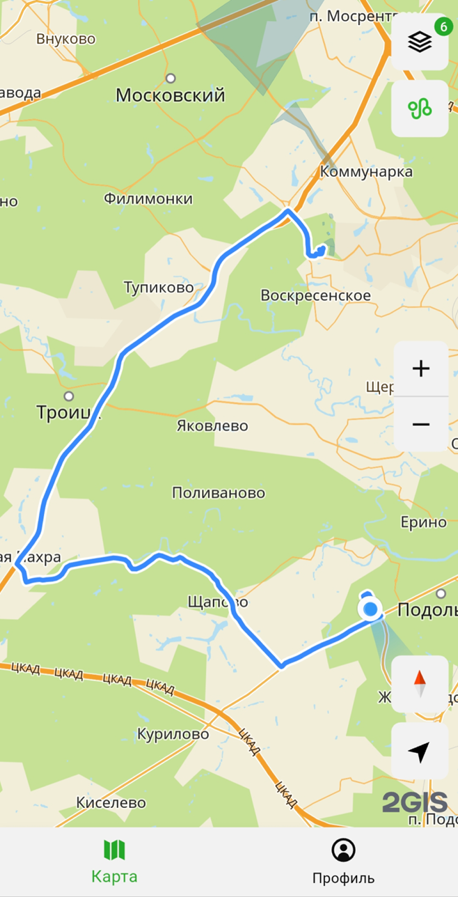
To clear the GPS track, go to the Settings tab and select Clear GPS track. The track will be deleted from your device but will remain in the web administrator panel.